_1793050830.webp)
On this page
Where is Morocco? Morocco is a country in the far northwest of Africa, only about 13 kilometers across the Strait of Gibraltar from Spain, with coastlines on both the Atlantic Ocean and the Mediterranean Sea. It's close enough to Europe to reach in a few hours, yet it feels a world away once you arrive.
The question we hear most often from first-time visitors isn't really about the map. It's what the location means in practice: how far is it, what is it like, and how do the pieces fit together? Here is the picture we give guests before they book, based on what we've seen since 2011.
The Short Answer
Morocco sits in North Africa, in the region known as the Maghreb. As Britannica describes it, it lies directly across the Strait of Gibraltar from Spain. The essentials fit in a short list:
- Continent: Africa, in the north-west corner
- Capital: Rabat, on the Atlantic coast. The largest city is Casablanca.
- Seas: the Atlantic Ocean to the west and the Mediterranean Sea to the north
- Population: about 36.8 million, according to the 2024 census
- Time zone: UTC+1 for most of the year, moving back to UTC+0 during Ramadan
- Languages: Arabic and Amazigh are official, and what language is spoken in Morocco in daily life also includes Darija, French and English
Morocco on the Map: Borders and Neighbors
To the east and south-east, Morocco shares a land border with Algeria. To the south lies the disputed territory of Western Sahara, and beyond it Mauritania. To the north, across the Strait of Gibraltar, is Spain, and Morocco also has two small Spanish enclaves on its Mediterranean coast, Ceuta and Melilla, which are the only land borders between Africa and the European Union.
Without counting Western Sahara, Morocco covers roughly 447,000 square kilometers, a little more than the state of California. It's a bigger country than most visitors expect, and that matters when you start planning a route.
Coasts, Mountains and Desert
Morocco's position gives it an unusually varied geography within a single country. Four landscapes shape most trips:
- The coasts. A long Atlantic shoreline runs from Tangier past Casablanca and Essaouira to Agadir, with a shorter Mediterranean stretch in the north.
- The Rif. A green mountain range in the north, where Chefchaouen sits.
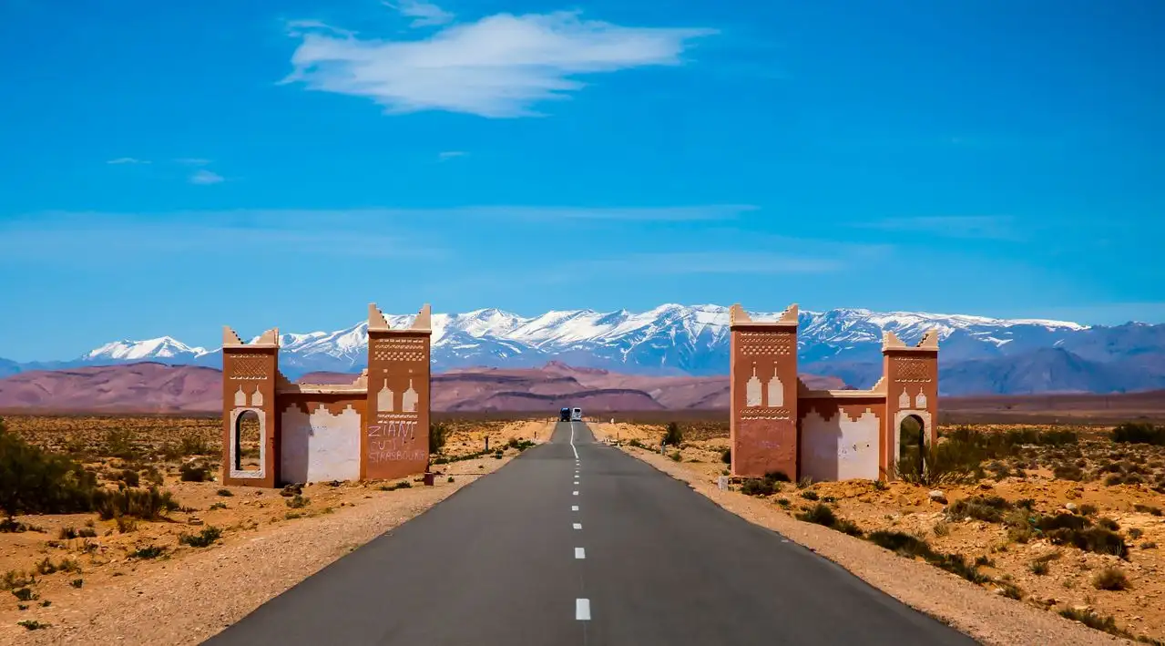
- The Atlas Mountains. A chain across the middle of the country. Jebel Toubkal, at 4,167 meters, is the highest peak in North Africa.
- The Sahara. In the south-east, where the sand dunes of Erg Chebbi near Merzouga rise out of the desert.
This is why a single trip can include a snowy mountain pass, a palm-lined valley, a walled medina and a night among the dunes. It is also why distances add up faster than the map suggests.
How Close Morocco Is to Europe
At its narrowest point, the Strait of Gibraltar is about 13 kilometers (8 miles) wide, according to Britannica's entry on the strait. In clear weather you can see the other continent from either shore. Ferries link the Spanish ports of Tarifa and Algeciras with Tangier and Tangier Med, and the fastest crossings take roughly an hour.
By air, Morocco is a short trip from most of Western Europe. A direct flight from London to Marrakech takes around three hours and forty minutes, and flights from Spain and France are shorter. From North America, the journey is longer, with direct flights to Casablanca from some cities and connections through Europe from others. Check current schedules before you book.
Where the Main Cities and Sights Are
Knowing where each place sits is the key to a realistic itinerary. The table below places the main stops, with rough driving times from Marrakech.
| Place | Where it is | Known for | From Marrakech |
|---|---|---|---|
| Marrakech | Inland, below the High Atlas | Medina, souks, gardens, a base for the Atlas and desert | Starting point |
| Casablanca | Atlantic coast | Largest city and main airport hub, Hassan II Mosque | About 3 hours by road |
| Rabat | Atlantic coast, north of Casablanca | The capital, calm and green | About 3.5 to 4 hours |
| Essaouira | Atlantic coast, west | Walled port, beaches, relaxed pace | About 2.5 to 3 hours |
| Fes | Inland, north-central | The oldest imperial city and its huge medina | A full day of driving |
| Chefchaouen | Rif Mountains, north | The blue town | A full day of driving |
| Merzouga | South-east, at the edge of the Sahara | Large dunes, desert camps | A full day of driving |
The practical lesson is that Morocco rewards a slower, region-based plan. If you are choosing where to go first, essential destinations for a first visit to Morocco helps you narrow the list, and it's better to see fewer places well than many in a rush.
How to Get There
Most international visitors arrive by air. The main gateways are Casablanca, Marrakech, Fes, Tangier and Agadir, with Marrakech the most convenient starting point for many itineraries. Travelers from southern Spain can also cross by ferry to Tangier and continue by road.
One tip that saves time: book your flights after the route is decided. Flying into one city and out of another, for example arriving in Marrakech and leaving from Casablanca, avoids backtracking and often gives you an extra day on the ground.
What the Location Means for the Weather
Morocco's position between the Atlantic, the Mediterranean and the Sahara gives it a climate that changes sharply from one region to the next. The north is Mediterranean, the Atlantic coast is cooler and breezier, the interior is hot in summer, and the desert has scorching days and cold nights. That is why the right month depends on where you plan to go, and the best time to visit Morocco differs between the coast, the cities and the Sahara.
Spring (March to May) and autumn (September to November) are the most comfortable seasons for most routes.
Frequently Asked Questions
Is Morocco in Africa or the Middle East?
Morocco is in Africa, in the north-west of the continent. It's part of the Arab world and of the Maghreb, but it is not in the Middle East.
How far is Morocco from Spain?
About 13 kilometers (8 miles) separate the two countries at the narrowest point of the Strait of Gibraltar. Ferries from Tarifa and Algeciras to Tangier take roughly an hour on the fastest routes.
What is the capital of Morocco?
Rabat is the capital. Casablanca is the largest city and the main business center, and Marrakech is the most visited city for tourists.
Which countries border Morocco?
Algeria to the east and south-east, and Mauritania to the south beyond the disputed territory of Western Sahara. Spain lies just across the Strait of Gibraltar and borders Morocco through the enclaves of Ceuta and Melilla.
What time zone is Morocco in?
Morocco uses UTC+1 for most of the year and moves back to UTC+0 during Ramadan. Check the current time difference before you book transfers and flights.
How long does it take to fly to Morocco?
From London, a direct flight to Marrakech takes around three hours and forty minutes. From the rest of Western Europe the journey is shorter, and from North America it is a long-haul flight.
Written by
Said, Senior Guide and co-founder of Morocco Tours. A former mountain guide, Said has been a guide certified by Morocco's national tourist office since 2009.
Knowing where Morocco is makes the trip easier to picture. Tell us when you plan to travel, how long you have and which regions appeal to you, and we'll build a route that fits the map.